By Art Stricklin at
Links Magazine with my own additional comments.
The Valero Texas Open is the third oldest stop on the PGA Tour behind only the Western and Canadian Opens, and it's the oldest stop to have been played in the same city every year. All 82 tournaments, going back to 1922, have been played in San Antonio.
Winners of the Texas Open could open their own wing at the World Golf Hall of Fame, starting with Walter Hagen, who captured the 1923 Texas Open with a total purse of $5,000, bigger than the U.S. Open at the time. Arnold Palmer had a three-peat–on three different courses no less–in the early '60s. In 1940, Byron Nelson and Ben Hogan staged one of their two PGA Tour playoffs with Nelson coming out the winnner, just like he did at the Masters two years later. Native son Ben Crenshaw won in his first-ever start as a member of the tour in 1973, and Tommy Armour III set the tour's scoring record of 254 (26 under) during the 2003 tournament.
Golf's legendary past, present and future have all come together for a Texas-sized golfing good time on some legendary Lone Star layouts at the Texas Open. Let's take a tour of the courses in chronological order:
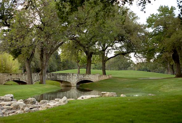
Brackenridge
HOST YEARS (21): 1922–26, 1929–40, 1950–55, 1957–59
PAR: 71
YARDAGE: 6,263
ARCHITECT: A.W. Tillinghast, John Colligan (
2008 restoration)
FACT: First public course in Texas, first public course with grass greens.
A very short course that I've played a half-dozen times, but not since the epic redesign in 2008. Several holes were completely changed, including a re-routing of holes 15-17. As most older courses in this area, elevation change is non-existant, but the premium is placed on accuracy, as tight, tree-lined fairways are what gives Brackenridge its teeth.Willow Springs
HOST YEARS (10): 1927–28, 1941–49
PAR: 72
YARDAGE: 6,930
ARCHITECTS: Emil Loeffler, John Bredemus,
Vern Schmidt (renovation)
FACT: Longest hole in San Antonio is the 663-yard 2nd.
One of my favorite courses in the area! I've loved every one of my 25+ visits, and am always reminded why I want to go back again. The famous 2nd hole is almost 700 yards long, and seems as if it just keeps curving to the right. Most holes here are relatively wide-open, so it's as good a course as any for those who struggle keeping their driver straight. It's the site of my career-longest drive of 345 yards. Hole #12, par-5, 544.. lotta wind that day! Certainly have played Willow Springs more than any other course in San Antonio.Fort Sam Houston (La Loma)
HOST YEARS (4): 1950–51, 1956, 1960
PAR: 72
YARDAGE: 6,566
ARCHITECT: A.W. Tillinghast
FACT: Last active-duty military base to host a PGA Tour event.
The company I used to work for had one of our yearly tournaments there one year, and I wasn't really impressed. Sure there are worse courses for your money, as it did have quite a bit of character, but just not the quality conditioning nor design. That was late '90's, though, so by now, it may be better.Oak Hills CC
HOST YEARS (23): 1961–66, 1977–94
PAR: 70
YARDAGE: 7,183
ARCHITECT: A.W. Tillinghast
FACT: Originally founded as Alamo CC in 1922 but ceased operations during WWII and reopened as Oak Hills in 1946.
The only course on this list, other than the new venue, that I've never played. It's a private club, so I can't exactly expect to have played it, but I have been to a tourney with my father when it was hosted there (probably late 80's). The par-3 18th at Oak Hills is a truly incredible golf hole!Pecan Valley
HOST YEARS (3): 1967, 1969–70
PAR: 71
YARDAGE: 7,183
ARCHITECT: Press Maxwell
FACT:
Also hosted 1968 PGA Championship won by Julius Boros with Arnold Palmer second.
No doubt about it - Pecan Valley is one of the toughest golf courses in existence. I've played it about 10 times and have never scored anywhere near my handicap. Super-tight fairways, several creeks crossing fairways, subtly slippery and undulating greens, and one of the toughest par-4's I've never made par on (#2). Pecan Valley is simply a must-play if you go to San Antonio! It's no wonder at all that a PGA Championship was hosted here. They need to come back!Woodlake
HOST YEARS (5): 1972–76
PAR: 72
YARDAGE: 7,143
ARCHITECT: Desmond Muirhead
FACT: Ben Crenshaw won his PGA Tour debut here in 1973.
Might just be my favorite course in San Antonio. Definitely top-4. When I wasn't at Willow Springs, I was here. It's always a really fun round of golf at Woodlake CC, simply because you're trying to putt some of the fastest, slick greens around. No wonder Crenshaw won here. The design is amazing, and the price is always just right too. As are most of these. I hadn't really touched on that yet, but along with Willow Springs, they won't break your bank, and you'll enjoy your round. Some of my best rounds have come here, but only because my putter was on that particular day.La Cantera (Resort Course)
HOST YEARS (15): 1995–2009
PAR: 70
YARDAGE: 6,881
ARCHITECTS: Jay Morrish and Tom Weiskopf
FACT: Named best new course in America when it opened in 1994; last Morrish-Weiskopf collaboration.
If it weren't for the price, there is no other place within an hour of me that I'd go play. Without a doubt La Cantera is my dream course. I've been here countless times for the Texas Open (including 1996 when Tiger and I had a 2-second pro-spectator encounter). I've only played the resort course about 6-7 times, and proudly hold onto the memory of a 27-hole extravaganza with Rick in which I shot 40-42-40. The course has more character than any course I've ever been to. Serious elevation changes to the point where countless PGA pros have complained (they won, sigh), but some of the best greens I've ever putted. The definition of a subtle break.. very fast.. very true. Shame on the PGA tour for taking the Open elsewhere!TPC San Antonio (Oaks Course)
HOST YEARS (2): 2010–2011
PAR: 72
YARDAGE: 7,435
ARCHITECTS: Greg Norman and Sergio Garcia
FACT: The second TPC course here will host a Champions Tour event this year.
No I haven't been there yet. The pictures and videos and reviews I've seen are incredible. We shall see if it's better than La Cantera.I guess I have my work cut out for me.Source


 HOST YEARS (21): 1922–26, 1929–40, 1950–55, 1957–59
 HOST YEARS (10): 1927–28, 1941–49
 HOST YEARS (4): 1950–51, 1956, 1960
 HOST YEARS (23): 1961–66, 1977–94
 HOST YEARS (3): 1967, 1969–70
 HOST YEARS (5): 1972–76
 HOST YEARS (15): 1995–2009
 HOST YEARS (2): 2010–2011


